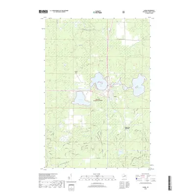
2018 Map of Laona
USGS Topo · Published 2018About this map
Laona sits as the central hub of this northern Wisconsin landscape, positioned at a crossroads between the Nicolet National Forest and a series of glacial lakes. The town's layout reflects its development around the railway and timber resources, with the Laona Cem and local school infrastructure marking its community core. To the east, Scattered Rice Lake, Little Birch Lake, and Birch Lake form a dense cluster of water bodies, while the Rat River meanders toward Silver Lake in the west. This area is characterized by a mix of managed forest lands and rural infrastructure, including the Heritage Acres Airport and various forest roads like Peshtigo River Road. A notable detail for historians is the mention of Starks Settlement / Roberts Lake to the southwest and Blackwell Junction to the southeast, points that speak to the legacy of settlement and rail junctions in Forest County.
Find a feature on this map
31 named features on this map. Tap any name to fly to it.
Don’t see what you’re looking for? This feature index may not catch every label — zoom into the map to look around manually.
Map Details
Editions of this 2018 Laona Map
This is the sole edition of this map. No revisions or reprints were ever made.
Other maps of this area

1939 · Crandon
USGS Topo · 1:48,000

1939 · Laona
USGS Topo · 1:48,000

1941 · Crandon
USGS Topo · 1:48,000

1942 · Wabeno
USGS Topo · 1:48,000

1942 · Pearson
USGS Topo · 1:48,000

1946 · Laona
USGS Topo · 1:48,000

1947 · Crandon
USGS Topo · 1:48,000

1950 · Wabeno
USGS Topo · 1:48,000

1950 · Lily
USGS Topo · 1:48,000

1951 · Wabeno
USGS Topo · 1:48,000