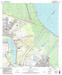
1992 Map of Laplace
USGS Topo · Published 1992About this map
The Bonnet Carre Floodway dominates this river-parish landscape, a massive structural feat of engineering designed to divert the Mississippi River into Lake Pontchartrain during flood stages. In the early 1990s, the surrounding communities of Laplace, Norco, and Montz are shown at a point of significant suburban expansion, with newer residential developments like Carrollwood and Riverland Heights appearing alongside established industrial zones. The economic engine of the era is clearly visible through the extensive Laplace Oil and Gas Field and Norco Oil and Gas Field. Local history is preserved in the location of the Montz Cem and numerous parochial institutions such as the Ascension of Our Lord Ch and St Joan of Arc Sch. Transportation networks, including the Illinois Central Gulf RR and the Lake Pontchartrain Causeway, define the movement between New Orleans and the river parishes.
Find a feature on this map
41 named features on this map. Tap any name to fly to it.
Don’t see what you’re looking for? This feature index may not catch every label — zoom into the map to look around manually.
Map Details
Editions of this 1992 Laplace Map
2 editions found
Other maps of this area

1891 · Hahnville
USGS Topo · 1:62,500

1892 · Lac Des Allemands
USGS Topo · 1:62,500

1892 · Mount Airy
USGS Topo · 1:62,500

1892 · Bonnet Carre
USGS Topo · 1:62,500

1932 · Hahnville NW
USGS Topo · 1:31,680

1932 · Lac Des Allemands NE
USGS Topo · 1:31,680

1932 · Hahnville NE
USGS Topo · 1:31,680

1935 · Laplace
USGS Topo · 1:31,680

1935 · Luling
USGS Topo · 1:31,680

1936 · Hahnville
USGS Topo · 1:31,680