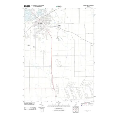
2010 Map of LaPorte East
USGS Topo · Published 2010About this map
La Porte serves as the primary hub of this 2010 survey, showing the city's residential and commercial expansion toward satellite communities like Monroe Manor and Salem Heights. To the northwest, a series of water bodies including Pine Lake, Stone Lake, and Lily Lake define the local topography, while the Laporte Fair Grounds stands near the urban core. To the south, the landscape transitions into a more organized grid of rural roads and drainage infrastructure, such as Travis Ditch, leading toward the settlement of Kingsbury. For local historians and genealogists, the map provides precise locations for three major burial grounds: Patton Cemetery, Saint Johns Cemetery, and Saint Josephs Cemetery. The presence of the La Porte Municipal Airport and the complex industrial layout along Hupp Rd and various numbered roads in the southeast corner reflects the modern economic character of the county.
Find a feature on this map
51 named features on this map. Tap any name to fly to it.
Don’t see what you’re looking for? This feature index may not catch every label — zoom into the map to look around manually.
Map Details
Editions of this 2010 LaPorte East Map
This is the sole edition of this map. No revisions or reprints were ever made.
Other maps of this area

1953 · Chicago
USGS Topo · 1:250,000

1957 · Chicago
USGS Topo · 1:250,000

1958 · Hanna
USGS Topo · 1:24,000

1958 · Kingsford Heights
USGS Topo · 1:24,000

1958 · Hamlet
USGS Topo · 1:24,000

1958 · Stillwell
USGS Topo · 1:24,000

1958 · Michigan City East
USGS Topo · 1:24,000

1958 · La Porte East
USGS Topo · 1:24,000

1958 · Springville
USGS Topo · 1:24,000

1958 · New Carlisle
USGS Topo · 1:24,000