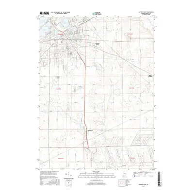
2016 Map of LaPorte East
USGS Topo · Published 2016About this map
The eastern edges of LaPorte dominate the northwestern quadrant of this survey, where the city's residential streets give way to the glacial lake system including Clear Lake, Lily Lake, and Stone Lake. The settlement pattern transitions from the dense urban grid of LaPorte into suburban developments like Monroe Manor and south toward Kingsbury. This landscape is defined by its complex drainage network, where the Little Kankakee River and various man-made channels like Breckenridge Ditch and Porter Ditch move water across the low-lying terrain. Genealogy researchers will find several significant burial sites mapped in detail, including Patton Cem, Saint Johns Cem, and Saint Josephs Cem. To the south, the La Porte Municipal Airport marks a significant modern landmark amidst a landscape still largely defined by agricultural sections and small watercourses like Kingsbury Cr and Ridge Run.
Find a feature on this map
155 named features on this map. Tap any name to fly to it.
Don’t see what you’re looking for? This feature index may not catch every label — zoom into the map to look around manually.
Map Details
Editions of this 2016 LaPorte East Map
This is the sole edition of this map. No revisions or reprints were ever made.
Other maps of this area

1953 · Chicago
USGS Topo · 1:250,000

1957 · Chicago
USGS Topo · 1:250,000

1958 · Hanna
USGS Topo · 1:24,000

1958 · Kingsford Heights
USGS Topo · 1:24,000

1958 · Hamlet
USGS Topo · 1:24,000

1958 · Stillwell
USGS Topo · 1:24,000

1958 · Michigan City East
USGS Topo · 1:24,000

1958 · La Porte East
USGS Topo · 1:24,000

1958 · Springville
USGS Topo · 1:24,000

1958 · New Carlisle
USGS Topo · 1:24,000