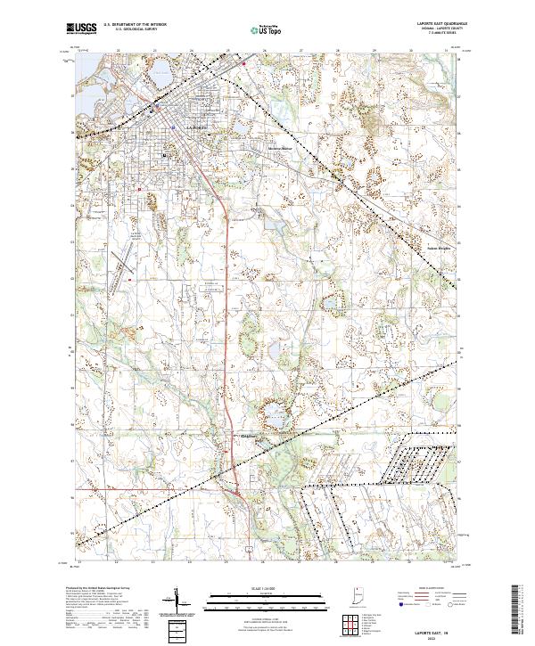
2022 Map of LaPorte East
USGS Topo · Published 2022About this map
La Porte serves as the focal point of this Indiana study, anchored by the La Porte County Courthouse and a dense residential grid. The city's geography is defined by its relationship with water, specifically the banks of Clear Lake and Lily Lake in the north. Settlement patterns extend outward to established neighborhoods like Monroe Manor and the southern hamlet of Kingsbury.
Find a feature on this map
74 named features on this map. Tap any name to fly to it.
Don’t see what you’re looking for? This feature index may not catch every label — zoom into the map to look around manually.
Map Details
Editions of this 2022 LaPorte East Map
This is the sole edition of this map. No revisions or reprints were ever made.
Other maps of this area

1953 · Chicago
USGS Topo · 1:250,000

1957 · Chicago
USGS Topo · 1:250,000

1958 · Hanna
USGS Topo · 1:24,000

1958 · Kingsford Heights
USGS Topo · 1:24,000

1958 · Hamlet
USGS Topo · 1:24,000

1958 · Stillwell
USGS Topo · 1:24,000

1958 · Michigan City East
USGS Topo · 1:24,000

1958 · La Porte East
USGS Topo · 1:24,000

1958 · Springville
USGS Topo · 1:24,000

1958 · New Carlisle
USGS Topo · 1:24,000