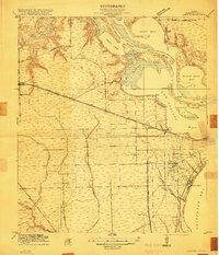
1916 Map of Laporte
USGS Topo · Published 1916About this map
The San Jacinto Battlefield stands as a prominent historical landmark overlooking the confluence of the San Jacinto River and the Buffalo Bayou, documenting the coastal landscape of Harris County shortly after the opening of the Houston-Galveston-Ship-Channel. The map captures the early development of La Porte and the shoreline attractions of Sylvan Beach, along with smaller railroad stops like Strang and Thayer. Three branches of the Southern Pacific System dominate the interior, connecting the industrializing waterfront to the rural hinterlands where the Lomax School and scattered farmsteads appear. Extensive wetlands and bays, including Peggy Lake and San Jacinto Bay, characterize the low-lying terrain, while Red Bluff and Spring Gully provide distinct geographical relief in an area defined by its complex network of sloughs and bayous.
Find a feature on this map
38 named features on this map. Tap any name to fly to it.
Don’t see what you’re looking for? This feature index may not catch every label — zoom into the map to look around manually.
Map Details
Editions of this 1916 Laporte Map
2 editions found
Other maps of this area

1915 · Deepwater
USGS Topo · 1:24,000

1916 · Genoa
USGS Topo · 1:24,000

1916 · Burnett Bay
USGS Topo · 1:24,000

1916 · Morgan Point
USGS Topo · 1:24,000

1916 · Seabrook
USGS Topo · 1:24,000

1916 · Fauna
USGS Topo · 1:24,000

1916 · Cedar Bayou
USGS Topo · 1:24,000

1916 · La Porte
USGS Topo · 1:24,000

1919 · Morgan Point
USGS Topo · 1:31,680

1919 · Deepwater
USGS Topo · 1:31,680