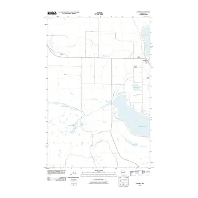
2010 Map of Laporte
USGS Topo · Published 2010About this map
Laporte serves as the primary hub of this Hubbard County landscape, situated along the Central Ave N Paul Bunyan Trl just north of the expansive Kabekona Lake. The settlement pattern is defined by rural road networks like Old Backboard Rd and Old Cemetary Rd, which lead to several local burial grounds including Saint Theodores Cemetery and Evergreen Cemetery.
Find a feature on this map
39 named features on this map. Tap any name to fly to it.
Don’t see what you’re looking for? This feature index may not catch every label — zoom into the map to look around manually.
Map Details
Editions of this 2010 Laporte Map
This is the sole edition of this map. No revisions or reprints were ever made.
Other maps of this area

1954 · Bemidji
USGS Topo · 1:250,000

1957 · Bemidji
USGS Topo · 1:250,000

1958 · Bemidji
USGS Topo · 1:250,000

1968 · Guthrie
USGS Topo · 1:24,000

1968 · Frontenac Lake
USGS Topo · 1:24,000
1972 · Mantrap Lake
USGS Topo · 1:24,000
1972 · East Crooked Lake
USGS Topo · 1:24,000

1972 · Benedict
USGS Topo · 1:24,000

1972 · Laporte
USGS Topo · 1:24,000

1972 · Lake George
USGS Topo · 1:24,000