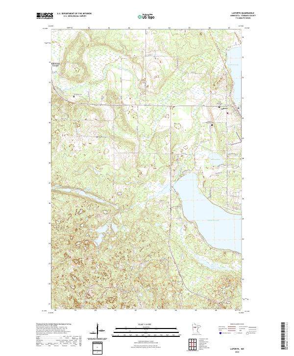
2022 Map of Laporte
USGS Topo · Published 2022About this map
Laporte sits at the heart of this landscape, positioned along the Paul Bunyan State Trail where the northern woods meet an extensive network of lakes and waterways. The community is anchored by local landmarks such as Saint Theodore's Cemetery and the Lakeport Township Cemetery, reflecting a settled history amidst the glacial topography of Hubbard County. To the west, Kabekona Corner provides a smaller focal point near the winding Kabekona River, which feeds into the large expanse of Kabekona Lake to the southeast.
Find a feature on this map
63 named features on this map. Tap any name to fly to it.
Don’t see what you’re looking for? This feature index may not catch every label — zoom into the map to look around manually.
Map Details
Editions of this 2022 Laporte Map
This is the sole edition of this map. No revisions or reprints were ever made.
Other maps of this area

1954 · Bemidji
USGS Topo · 1:250,000

1957 · Bemidji
USGS Topo · 1:250,000

1958 · Bemidji
USGS Topo · 1:250,000

1968 · Guthrie
USGS Topo · 1:24,000

1968 · Frontenac Lake
USGS Topo · 1:24,000
1972 · Mantrap Lake
USGS Topo · 1:24,000
1972 · East Crooked Lake
USGS Topo · 1:24,000

1972 · Benedict
USGS Topo · 1:24,000

1972 · Laporte
USGS Topo · 1:24,000

1972 · Lake George
USGS Topo · 1:24,000