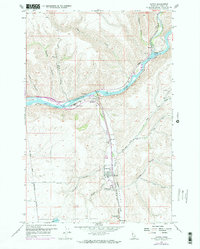
1958 Map of Lapwai
USGS Topo · Published 1973About this map
The Clearwater River and its junction with the Potlatch River anchor this mid-century look at the Nez Perce Reservation. The map documents a complex landscape of tribal administration and regional infrastructure, prominently featuring the North Idaho Indian Agency and the Nez Perce Nat Historical Park near Spalding. The settlement pattern follows the valley floor of Lapwai Creek, where Lapwai and North Lapwai sit along the Camas Prairie railroad line.
Find a feature on this map
40 named features on this map. Tap any name to fly to it.
Don’t see what you’re looking for? This feature index may not catch every label — zoom into the map to look around manually.
Map Details
Editions of this 1958 Lapwai Map
3 editions found
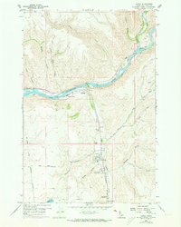
Other maps of this area

1955 · Pullman
USGS Topo · 1:250,000

1958 · Pullman
USGS Topo · 1:250,000

1958 · Lapwai
USGS Topo · 1:24,000

1958 · Sweetwater
USGS Topo · 1:24,000

1958 · Lewiston Orchards North
USGS Topo · 1:24,000

1958 · Lewiston Orchards South
USGS Topo · 1:24,000

1958 · Lewiston Orchards
USGS Topo · 1:62,500

1958 · Culdesac
USGS Topo · 1:62,500

1961 · Kendrick
USGS Topo · 1:62,500

1961 · Moscow
USGS Topo · 1:62,500