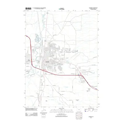
2012 Map of Laramie
USGS Topo · Published 2012About this map
Laramie and its immediate surroundings are captured in this early 21st-century survey, centered on the historic campus of the University of Wyoming. The town's grid is bounded to the west by the Laramie River, which separates the main city from West Laramie. Neighborhood details are densely documented, showing prominent green spaces like Undine Park and Washington Park, along with the Green Hill Cem just north of the university.
Find a feature on this map
67 named features on this map. Tap any name to fly to it.
Don’t see what you’re looking for? This feature index may not catch every label — zoom into the map to look around manually.
Map Details
Editions of this 2012 Laramie Map
This is the sole edition of this map. No revisions or reprints were ever made.
Other maps of this area

1895 · Laramie
USGS Topo · 1:125,000

1902 · Laramie
USGS Topo · 1:125,000

1905 · Sherman
USGS Topo · 1:125,000

1905 · Laramie
USGS Topo · 1:125,000

1906 · Laramie
USGS Topo · 1:125,000

1908 · Laramie
USGS Topo · 1:125,000

1948 · Sherman Mountains
USGS Topo · 1:62,500

1948 · Ragged Top Mountain
USGS Topo · 1:62,500

1950 · Ragged Top Mountain
USGS Topo · 1:62,500

1950 · Sherman Mountains
USGS Topo · 1:62,500