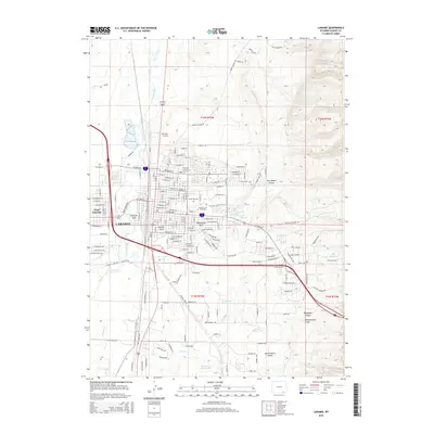
2015 Map of Laramie
USGS Topo · Published 2015About this map
The University of Wyoming serves as a central anchor for the city of Laramie, which dominates the western half of this Wyoming high-plains landscape. The street grid is neatly organized around the campus and several green spaces, including Washington Park and Undine Park. To the west, the Laramie River meanders past West Laramie, while the eastern terrain rises toward the Laramie Mountains, deeply incised by Jack Rabbit Canyon and Telephone Canyon. This area reflects the expansion of educational and technical institutions like Wyo Tech-Laramie alongside traditional ranching and transportation corridors. Local history is documented at Green Hill Cem and along historical routes like Fort Buford Ln, while various water features such as City Springs and Woodhouse Reservoir dot the arid landscape, marking the vital water management systems of the region.
Find a feature on this map
114 named features on this map. Tap any name to fly to it.
Don’t see what you’re looking for? This feature index may not catch every label — zoom into the map to look around manually.
Map Details
Editions of this 2015 Laramie Map
This is the sole edition of this map. No revisions or reprints were ever made.
Other maps of this area

1895 · Laramie
USGS Topo · 1:125,000

1902 · Laramie
USGS Topo · 1:125,000

1905 · Sherman
USGS Topo · 1:125,000

1905 · Laramie
USGS Topo · 1:125,000

1906 · Laramie
USGS Topo · 1:125,000

1908 · Laramie
USGS Topo · 1:125,000

1948 · Sherman Mountains
USGS Topo · 1:62,500

1948 · Ragged Top Mountain
USGS Topo · 1:62,500

1950 · Ragged Top Mountain
USGS Topo · 1:62,500

1950 · Sherman Mountains
USGS Topo · 1:62,500