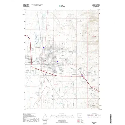
2017 Map of Laramie
USGS Topo · Published 2017About this map
The Univ of Wyoming campus and the surrounding residential grids of Laramie dominate this 2017 study of Albany County's high-plains geography. The city's structure is defined by the Laramie River to the west and the expansive green spaces of Washington Park, Undine Park, and the Green Hill Cem. The map provides an intricate look at the local infrastructure, from the suburban interface of West Laramie to the distinctive industrial and ranching fringes where the Rock & A Hard Place Ranch Airport sits near the base of the Laramie Mountains.
Find a feature on this map
111 named features on this map. Tap any name to fly to it.
Don’t see what you’re looking for? This feature index may not catch every label — zoom into the map to look around manually.
Map Details
Editions of this 2017 Laramie Map
This is the sole edition of this map. No revisions or reprints were ever made.
Other maps of this area

1895 · Laramie
USGS Topo · 1:125,000

1902 · Laramie
USGS Topo · 1:125,000

1905 · Sherman
USGS Topo · 1:125,000

1905 · Laramie
USGS Topo · 1:125,000

1906 · Laramie
USGS Topo · 1:125,000

1908 · Laramie
USGS Topo · 1:125,000

1948 · Sherman Mountains
USGS Topo · 1:62,500

1948 · Ragged Top Mountain
USGS Topo · 1:62,500

1950 · Ragged Top Mountain
USGS Topo · 1:62,500

1950 · Sherman Mountains
USGS Topo · 1:62,500