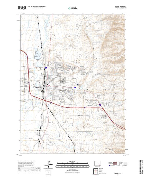
2021 Map of Laramie
USGS Topo · Published 2021About this map
The University of Wyoming serves as a central anchor for this high-plains city, where the grid of Laramie meets the sweeping terrain of the Laramie Basin. The map highlights the town's administrative and spiritual core, including the Albany County Courthouse and Saint Mathews Church, alongside established residential areas bounded by the Union Pacific RR. The landscape to the west and south reveals the vital role of water management in this arid region, marked by the Pioneer Canal, Woodhouse Reservoir, and the meandering path of the Laramie River. To the east, the topography shifts dramatically toward Telephone Canyon and Jack Rabbit Canyon, showing the transition from the city's urban street plan to the rugged canyons of the Laramie Range foothills.
Find a feature on this map
103 named features on this map. Tap any name to fly to it.
Don’t see what you’re looking for? This feature index may not catch every label — zoom into the map to look around manually.
Map Details
Editions of this 2021 Laramie Map
This is the sole edition of this map. No revisions or reprints were ever made.
Other maps of this area

1895 · Laramie
USGS Topo · 1:125,000

1902 · Laramie
USGS Topo · 1:125,000

1905 · Sherman
USGS Topo · 1:125,000

1905 · Laramie
USGS Topo · 1:125,000

1906 · Laramie
USGS Topo · 1:125,000

1908 · Laramie
USGS Topo · 1:125,000

1948 · Sherman Mountains
USGS Topo · 1:62,500

1948 · Ragged Top Mountain
USGS Topo · 1:62,500

1950 · Ragged Top Mountain
USGS Topo · 1:62,500

1950 · Sherman Mountains
USGS Topo · 1:62,500