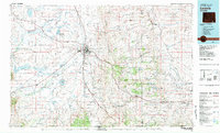
1981 Map of Laramie
USGS Topo · Published 1981About this map
Laramie serves as the central hub of this 1981 survey, where the Union Pacific railroad and major highways converge against the backdrop of the Laramie Mountains. The landscape transitions from the broad, lake-dotted expanse of the Big Hollow to the timbered heights of the Medicine Bow National Forest. This region is defined by a complex hydrology of irrigation and storage, including the Lake Hattie Reservoir, Soda Lakes, and an aqueduct system. Historically significant routes like the Overland Trail and Pacific Trail cross the terrain, marking the legacy of westward migration. Smaller settlements such as Red Buttes, Howell, and Tie Siding are documented along the rail line, while protected areas like the Bamforth National Wildlife Refuge preserve the alkaline lake basins characteristic of the high plains.
Find a feature on this map
81 named features on this map. Tap any name to fly to it.
Don’t see what you’re looking for? This feature index may not catch every label — zoom into the map to look around manually.
Map Details
Editions of this 1981 Laramie Map
2 editions found
Other maps of this area

1895 · Laramie
USGS Topo · 1:125,000

1902 · Laramie
USGS Topo · 1:125,000

1905 · Sherman
USGS Topo · 1:125,000

1905 · Laramie
USGS Topo · 1:125,000

1906 · Medicine Bow
USGS Topo · 1:125,000

1906 · Laramie
USGS Topo · 1:125,000

1907 · Livermore
USGS Topo · 1:125,000

1908 · Laramie
USGS Topo · 1:125,000

1908 · Medicine Bow
USGS Topo · 1:125,000

1908 · Eaton
USGS Topo · 1:125,000