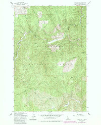
1965 Map of Larch Butte
USGS Topo · Published 1984About this map
Clearwater National Forest dominates this mid-century topographic study, defined by a complex network of high ridges and deep drainage basins. The landscape is structured around the primary course of Orogrande Creek, which winds through the northwestern corner, fed by numerous tributaries including Hook Creek and Tama Creek. Prominent high points such as Larch Butte and Gobblers Knob anchor the topography, while Tamarack Ridge and Hemlock Ridge provide the primary north-south orientations for the terrain. Sparse human imprints are visible via a system of mountain access routes, notably the Jeep Trail and Pack Trail. These trails connect isolated locations such as Three Bear Camp and the site at Sylvan, reflecting the area's history as a managed wilderness utilized for timber and resource oversight prior to the modern road era.
Find a feature on this map
32 named features on this map. Tap any name to fly to it.
Don’t see what you’re looking for? This feature index may not catch every label — zoom into the map to look around manually.
Map Details
Editions of this 1965 Larch Butte Map
2 editions found
Other maps of this area

1911 · Lolo
USGS Topo · 1:250,000

1913 · Lolo
USGS Topo · 1:250,000

1923 · Washington Creek
USGS Topo · 1:125,000

1924 · Weippe
USGS Topo · 1:125,000

1956 · Hamilton
USGS Topo · 1:250,000

1959 · Hamilton
USGS Topo · 1:250,000

1960 · Hamilton
USGS Topo · 1:250,000

1963 · Clarke Mtn
USGS Topo · 1:24,000

1964 · Hamilton
USGS Topo · 1:250,000

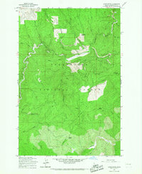
1965 · Lean-to Point
USGS Topo · 1:24,000