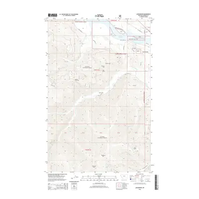
2014 Map of Larchwood
USGS Topo · Published 2014About this map
Noxon Reservoir dominates the northern reaches of this landscape, where the Clark Fork River valley is constrained by the rising elevations of the Kanisku National Forest. The small settlement of Larchwood sits along the eastern shore, positioned near the intersection of Mt-200 and S Shore Dr. This area reflects the transition from river-bottom transportation corridors to the steep mountain peaks that define the interior of Sanders County.
Find a feature on this map
38 named features on this map. Tap any name to fly to it.
Don’t see what you’re looking for? This feature index may not catch every label — zoom into the map to look around manually.
Map Details
Editions of this 2014 Larchwood Map
This is the sole edition of this map. No revisions or reprints were ever made.
Other maps of this area

1932 · Trout Creek
USGS Topo · 1:125,000

1935 · Trout Creek
USGS Topo · 1:125,000

1936 · Trout Creek
USGS Topo · 1:125,000

1956 · Cooper Gulch
USGS Topo · 1:62,500

1956 · Wallace
USGS Topo · 1:250,000

1957 · Burke
USGS Topo · 1:62,500

1960 · Wallace
USGS Topo · 1:250,000
1966 · Goat Peak
USGS Topo · 1:24,000
1966 · Noxon Rapids Dam
USGS Topo · 1:24,000
1966 · Bloom Peak
USGS Topo · 1:24,000