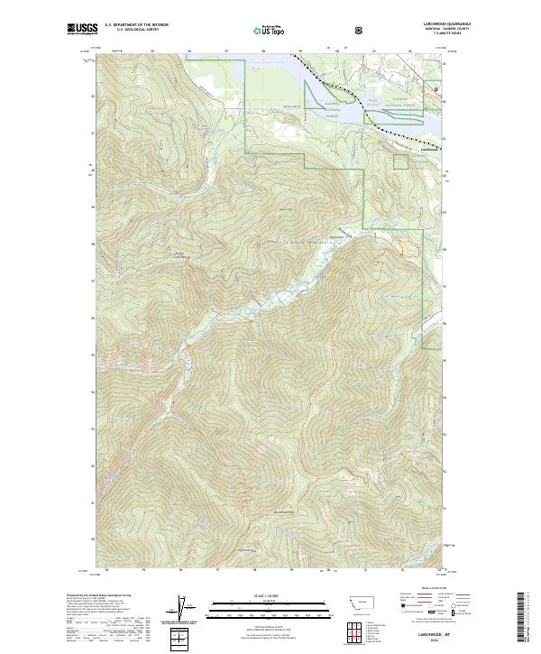
2024 Map of Larchwood
USGS Topo · Published 2024About this map
The tiny settlement of Larchwood sits on the eastern edge of the Kaniksu National Forest, positioned above the expansive waters of the Noxon Reservoir. This landscape is dominated by the steep, drainage-cut slopes of the Coeur d'Alene Mountains, where numerous gulches like Sage Gulch and Veals Gulch feed into the complex system of the Trout Creek watershed. The terrain is marked by significant peaks, including Beecher Peak, Woodchuck Peak, and Eightmile Peak, linked by a network of forest trails and primitive roads.
Find a feature on this map
45 named features on this map. Tap any name to fly to it.
Don’t see what you’re looking for? This feature index may not catch every label — zoom into the map to look around manually.
Map Details
Editions of this 2024 Larchwood Map
This is the sole edition of this map. No revisions or reprints were ever made.
Other maps of this area

1932 · Trout Creek
USGS Topo · 1:125,000

1935 · Trout Creek
USGS Topo · 1:125,000

1936 · Trout Creek
USGS Topo · 1:125,000

1956 · Cooper Gulch
USGS Topo · 1:62,500

1956 · Wallace
USGS Topo · 1:250,000

1957 · Burke
USGS Topo · 1:62,500

1960 · Wallace
USGS Topo · 1:250,000
1966 · Goat Peak
USGS Topo · 1:24,000
1966 · Noxon Rapids Dam
USGS Topo · 1:24,000
1966 · Bloom Peak
USGS Topo · 1:24,000