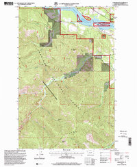
1997 Map of Larchwood
USGS Topo · Published 2000About this map
Clark Fork valley life in the late twentieth century is defined by the expansive Noxon Reservoir, which dominates the northern reaches of this Montana landscape. The small settlement of Larchwood sits on the southern bank, situated near where the reservoir begins to narrow back into the river's original channel. This area is heavily influenced by the presence of the Kaniksu National Forest, which is noted as being administered by the Kootenai National Forest on this specific sheet.
Find a feature on this map
25 named features on this map. Tap any name to fly to it.
Don’t see what you’re looking for? This feature index may not catch every label — zoom into the map to look around manually.
Map Details
Editions of this 1997 Larchwood Map
This is the sole edition of this map. No revisions or reprints were ever made.
Other maps of this area

1932 · Trout Creek
USGS Topo · 1:125,000

1935 · Trout Creek
USGS Topo · 1:125,000

1936 · Trout Creek
USGS Topo · 1:125,000

1956 · Cooper Gulch
USGS Topo · 1:62,500

1956 · Wallace
USGS Topo · 1:250,000

1957 · Burke
USGS Topo · 1:62,500

1960 · Wallace
USGS Topo · 1:250,000
1966 · Goat Peak
USGS Topo · 1:24,000
1966 · Noxon Rapids Dam
USGS Topo · 1:24,000
1966 · Bloom Peak
USGS Topo · 1:24,000