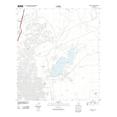
2010 Map of Laredo East
USGS Topo · Published 2010About this map
Lake Casa Blanca dominates the landscape of this eastern Laredo region, serving as a central geographic anchor for both residential expansion and industrial infrastructure. The 2010 landscape shows the suburban growth of Del Mar and the extensive commercial corridors along Bob Bullock Loop, Nafta Blvd, and Union Pacific Blvd. This era captures the city's significant role in international trade and aviation, with the sprawling grounds of the Laredo International Airport positioned west of the reservoir.
Find a feature on this map
36 named features on this map. Tap any name to fly to it.
Don’t see what you’re looking for? This feature index may not catch every label — zoom into the map to look around manually.
Map Details
Editions of this 2010 Laredo East Map
This is the sole edition of this map. No revisions or reprints were ever made.
Other maps of this area

1933 · Becerra Creek
USGS Topo · 1:62,500

1956 · Islitas
USGS Topo · 1:62,500

1956 · Laredo East
USGS Topo · 1:62,500

1956 · Laredo
USGS Topo · 1:250,000

1965 · Laredo West
USGS Topo · 1:24,000

1965 · Orvil
USGS Topo · 1:24,000

1965 · Cuervo Creek
USGS Topo · 1:24,000

1965 · Cibolo Ranch
USGS Topo · 1:24,000

1965 · Tios Creek
USGS Topo · 1:24,000

1965 · Laredo East
USGS Topo · 1:24,000