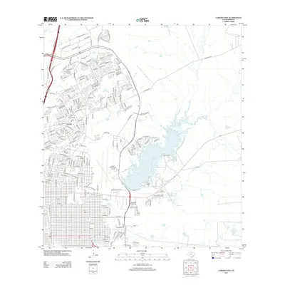
2013 Map of Laredo East
USGS Topo · Published 2013About this map
Lake Casa Blanca dominates the central landscape of this 2013 survey, serving as a focal point for the eastern expansion of Laredo. The area is defined by a blend of significant infrastructure and semi-rural ranch lands, most notably the Laredo International Airport and the sprawling Killam Ranch. Residential development is concentrated in neighborhoods like Del Mar, while several named water features such as Lake Carnegie, Lake Victoria, and Lake Powell suggest a managed hydrological system supporting local recreation and agriculture.
Find a feature on this map
210 named features on this map. Tap any name to fly to it.
Don’t see what you’re looking for? This feature index may not catch every label — zoom into the map to look around manually.
Map Details
Editions of this 2013 Laredo East Map
This is the sole edition of this map. No revisions or reprints were ever made.
Other maps of this area

1933 · Becerra Creek
USGS Topo · 1:62,500

1956 · Islitas
USGS Topo · 1:62,500

1956 · Laredo East
USGS Topo · 1:62,500

1956 · Laredo
USGS Topo · 1:250,000

1965 · Laredo West
USGS Topo · 1:24,000

1965 · Orvil
USGS Topo · 1:24,000

1965 · Cuervo Creek
USGS Topo · 1:24,000

1965 · Cibolo Ranch
USGS Topo · 1:24,000

1965 · Tios Creek
USGS Topo · 1:24,000

1965 · Laredo East
USGS Topo · 1:24,000