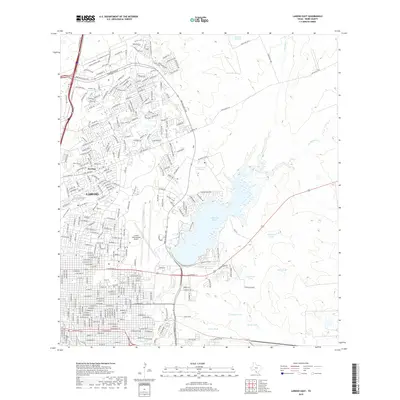
2019 Map of Laredo East
USGS Topo · Published 2019About this map
The expanding city of Laredo meets the South Texas brush country in this 2019 survey, centered on the infrastructure and hydrology of the eastern suburbs. The landscape is anchored by Lake Casa Blanca, a significant reservoir surrounded by a network of drainage channels like Chacon Cr and Zacate Cr. The influence of transportation and global trade is evident in the sprawling layout of the Laredo International Airport and industrial corridors like Nafta Blvd and E Corridor Rd, reflecting the city's role as a major inland port and logistics hub.
Find a feature on this map
278 named features on this map. Tap any name to fly to it.
Don’t see what you’re looking for? This feature index may not catch every label — zoom into the map to look around manually.
Map Details
Editions of this 2019 Laredo East Map
This is the sole edition of this map. No revisions or reprints were ever made.
Other maps of this area

1933 · Becerra Creek
USGS Topo · 1:62,500

1956 · Islitas
USGS Topo · 1:62,500

1956 · Laredo East
USGS Topo · 1:62,500

1956 · Laredo
USGS Topo · 1:250,000

1965 · Laredo West
USGS Topo · 1:24,000

1965 · Orvil
USGS Topo · 1:24,000

1965 · Cuervo Creek
USGS Topo · 1:24,000

1965 · Cibolo Ranch
USGS Topo · 1:24,000

1965 · Tios Creek
USGS Topo · 1:24,000

1965 · Laredo East
USGS Topo · 1:24,000