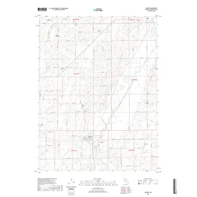
2017 Map of Laredo
USGS Topo · Published 2017About this map
Medicine Creek and its many tributaries, including Black Oak Br and N Fork Crooked Cr, define the agricultural landscape of eastern Grundy County. This modern topographic survey illustrates a rural region centered on the small settlements of Laredo and Dunlap, with the outskirts of Galt appearing in the northeast corner. The map is particularly valuable for genealogists and local historians, as it meticulously identifies numerous small family and community burial grounds that dot the countryside, such as the Honey Creek Chapel Cem, Rural Dale Cem, and Joab Holloway Cem. The terrain is characterized by the watershed of Little Medicine Creek and Honey Creek, where the road network follows a strict sectional grid interrupted only by the meandering stream beds and the waters of Broyles Lake and Curtis Upper Lake.
Find a feature on this map
84 named features on this map. Tap any name to fly to it.
Don’t see what you’re looking for? This feature index may not catch every label — zoom into the map to look around manually.
Map Details
Editions of this 2017 Laredo Map
This is the sole edition of this map. No revisions or reprints were ever made.
Other maps of this area

1921 · Chillicothe
USGS Topo · 1:62,500

1923 · Chillicothe
USGS Topo · 1:62,500

1924 · Chula
USGS Topo · 1:62,500

1946 · Galt
USGS Topo · 1:62,500

1947 · Chula
USGS Topo · 1:62,500

1948 · Trenton
USGS Topo · 1:62,500

1949 · Galt
USGS Topo · 1:62,500

1953 · Moberly
USGS Topo · 1:250,000

1954 · Centerville
USGS Topo · 1:250,000

1954 · Moberly
USGS Topo · 1:250,000