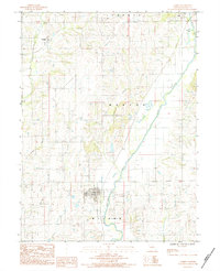
1984 Map of Laredo
USGS Topo · Published 1984About this map
Laredo serves as the primary community center in this portion of Grundy County, characterized by a regular grid of streets and structures positioned south of the Medicine Creek basin. This topographic record, compiled from early 1980s photography, illustrates a landscape defined by the drainage patterns of North Missouri, where larger waterways like Crooked Creek and No Creek meander through the townships of Marion, Wilson, and Liberty. The settlement at Galt occupies the northeast corner, while Dunlap is situated further west along the upper reaches of No Creek.
Find a feature on this map
13 named features on this map. Tap any name to fly to it.
Don’t see what you’re looking for? This feature index may not catch every label — zoom into the map to look around manually.
Map Details
Editions of this 1984 Laredo Map
This is the sole edition of this map. No revisions or reprints were ever made.
Other maps of this area

1921 · Chillicothe
USGS Topo · 1:62,500

1923 · Chillicothe
USGS Topo · 1:62,500

1924 · Chula
USGS Topo · 1:62,500

1946 · Galt
USGS Topo · 1:62,500

1947 · Chula
USGS Topo · 1:62,500

1948 · Trenton
USGS Topo · 1:62,500

1949 · Galt
USGS Topo · 1:62,500

1953 · Moberly
USGS Topo · 1:250,000

1954 · Centerville
USGS Topo · 1:250,000

1954 · Moberly
USGS Topo · 1:250,000