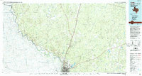
1985 Map of Laredo
USGS Topo · Published 1993About this map
The Rio Grande serves as the international boundary in this mid-1980s look at the borderlands, anchoring the interconnected urban centers of Laredo and Nuevo Laredo. The landscape radiates from this river corridor into the brush country of Webb County, defined by a network of ranching outposts and rail-dependent settlements. Major transportation arteries like Interstate 35 and U S Highway 83 cut northward, passing through locales such as Webb and Callaghan. The local economy and geography are further shaped by the Missouri Pacific Railroad and the Texas Mexican Railway, which connect the border to the interior. Notable local landmarks include the Laredo International Airport and the recreational waters of Lake Casa Blanca, while numerous arroyos like Arroyo del Venado and Arroyo de los Melones carve through the terrain toward the river.
Find a feature on this map
56 named features on this map. Tap any name to fly to it.
Don’t see what you’re looking for? This feature index may not catch every label — zoom into the map to look around manually.
Map Details
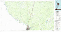
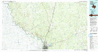
Editions of this 1985 Laredo Map
3 editions found
Other maps of this area

1923 · Palafox
USGS Topo · 1:62,500

1929 · Cotulla
USGS Topo · 1:125,000

1933 · Becerra Creek
USGS Topo · 1:62,500

1937 · Aguilete Creek
USGS Topo · 1:62,500

1939 · Bruni
USGS Topo · 1:62,500

1940 · Aguilares
USGS Topo · 1:62,500

1940 · Velenzuela Creek
USGS Topo · 1:62,500

1940 · San Loranzo Creek
USGS Topo · 1:62,500

1940 · Chupadera
USGS Topo · 1:62,500

1953 · Crystal City
USGS Topo · 1:250,000