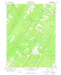
1973 Map of Largent
USGS Topo · Published 1975About this map
The Cacapon River carves deep, dramatic oxbows through the Appalachian ridges of Morgan and Hampshire counties in this early 1970s survey. The landscape is defined by the massive spine of Sideling Hill and Little Cacapon Mountain, where the river’s winding course created isolated pockets for small settlements like Largent and Forks of Cacapon. Near the southern bend of the river at Bloomery, an Iron Ore Furnace stands as a tangible marker of the region’s earlier industrial history. Local genealogy and community life are anchored by several rural landmarks, including Island Hill Ch, Mt Union Ch, and the high-elevation crossing at Spring Gap. From the riverside Quarry to the Radio Tower on the southern heights, the map documents a terrain where transportation and industry have long been dictated by the narrow gaps and steep hollows of the West Virginia panhandle.
Find a feature on this map
31 named features on this map. Tap any name to fly to it.
Don’t see what you’re looking for? This feature index may not catch every label — zoom into the map to look around manually.
Map Details
Editions of this 1973 Largent Map
2 editions found
Other maps of this area

1891 · Romney
USGS Topo · 1:125,000

1894 · Winchester
USGS Topo · 1:125,000

1898 · Paw Paw
USGS Topo · 1:62,500

1899 · Flintstone
USGS Topo · 1:62,500

1900 · Pawpaw
USGS Topo · 1:62,500

1900 · Flintstone
USGS Topo · 1:62,500

1910 · Paw Paw
USGS Topo · 1:62,500

1916 · Capon Bridge
USGS Topo · 1:62,500

1921 · Hanging Rock
USGS Topo · 1:48,000

1923 · Capon Bridge
USGS Topo · 1:62,500