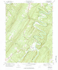
1973 Map of Largent
USGS Topo · Published 1984About this map
The Cacapon River winds in deep, dramatic loops through this section of the Appalachian Mountains, creating a complex landscape of ridges and water-carved valleys. The settlement at Largent and the nearby Forks of Cacapon represent historic nodes of activity where local transport met the river. Steep topographic features like Sideling Hill and Little Cacapon Mountain define the north-south orientation of the terrain, limiting most development to the narrow riverbanks and hollows.
Find a feature on this map
37 named features on this map. Tap any name to fly to it.
Don’t see what you’re looking for? This feature index may not catch every label — zoom into the map to look around manually.
Map Details
Editions of this 1973 Largent Map
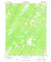
2 editions found
Other maps of this area

1891 · Romney
USGS Topo · 1:125,000

1894 · Winchester
USGS Topo · 1:125,000

1898 · Paw Paw
USGS Topo · 1:62,500

1899 · Flintstone
USGS Topo · 1:62,500

1900 · Pawpaw
USGS Topo · 1:62,500

1900 · Flintstone
USGS Topo · 1:62,500

1910 · Paw Paw
USGS Topo · 1:62,500

1916 · Capon Bridge
USGS Topo · 1:62,500

1921 · Hanging Rock
USGS Topo · 1:48,000

1923 · Capon Bridge
USGS Topo · 1:62,500