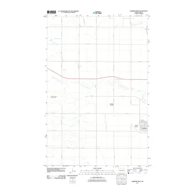
2011 Map of Larimore West
USGS Topo · Published 2011About this map
Larimore occupies the southeastern corner of this map, its grid of streets including W Front St and Garrison Ave marking the western edge of the town center. To the west, the landscape is defined by the hydrologic network of the Turtle River system. The South Branch Turtle River winds across the central section, controlled by the Upper Turtle River Number 8 Dam. This 2011 survey captures the area just before significant modern changes, showing the agricultural surroundings and the transition from town streets to rural routes like 18th Ave. North of the main settlement, the rail crossing at Hannah Junction and the Larimore Municipal Airport provide a look at the transportation infrastructure serving this portion of Grand Forks County. Farther north, smaller drainages like Whisky Creek and the North Branch Turtle River cut through the prairie grain fields.
Find a feature on this map
40 named features on this map. Tap any name to fly to it.
Don’t see what you’re looking for? This feature index may not catch every label — zoom into the map to look around manually.
Map Details
Editions of this 2011 Larimore West Map
This is the sole edition of this map. No revisions or reprints were ever made.
Other maps of this area

1936 · Larimore
USGS Topo · 1:62,500

1939 · Niagara
USGS Topo · 1:62,500

1952 · Grand Forks
USGS Topo · 1:250,000

1952 · Thief River Falls
USGS Topo · 1:250,000

1956 · Thief River Falls
USGS Topo · 1:250,000

1956 · Grand Forks
USGS Topo · 1:250,000

1957 · Thief River Falls
USGS Topo · 1:250,000

1963 · Orr
USGS Topo · 1:24,000

1963 · Larimore East
USGS Topo · 1:24,000

1963 · Kempton
USGS Topo · 1:24,000