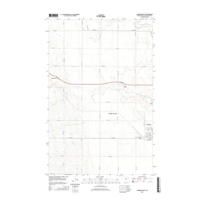
2014 Map of Larimore West
USGS Topo · Published 2014About this map
Larimore anchors the eastern edge of this Red River Valley landscape, where the grid of the city meets the broad agricultural expanse of Grand Forks County. The town's western reaches are detailed down to the street level, including Wolcott Ave and Elevator Rd, serving as a gateway to the surrounding prairie. To the west, the settlement of Shawnee and the crossroads at Hannah Junction illustrate the rural distribution typical of this region. The terrain is defined by the winding paths of the N Br Turtle River and S Br Turtle River, which cut through a landscape otherwise dominated by a precise section-line road network. Aviation history and modern utility are represented by both the Larimore Municipal Airport and the smaller Bakke Airport, while the Bellevue Cem provides a point of genealogical interest for those tracing local family histories.
Find a feature on this map
34 named features on this map. Tap any name to fly to it.
Don’t see what you’re looking for? This feature index may not catch every label — zoom into the map to look around manually.
Map Details
Editions of this 2014 Larimore West Map
This is the sole edition of this map. No revisions or reprints were ever made.
Other maps of this area

1936 · Larimore
USGS Topo · 1:62,500

1939 · Niagara
USGS Topo · 1:62,500

1952 · Grand Forks
USGS Topo · 1:250,000

1952 · Thief River Falls
USGS Topo · 1:250,000

1956 · Thief River Falls
USGS Topo · 1:250,000

1956 · Grand Forks
USGS Topo · 1:250,000

1957 · Thief River Falls
USGS Topo · 1:250,000

1963 · Orr
USGS Topo · 1:24,000

1963 · Larimore East
USGS Topo · 1:24,000

1963 · Kempton
USGS Topo · 1:24,000