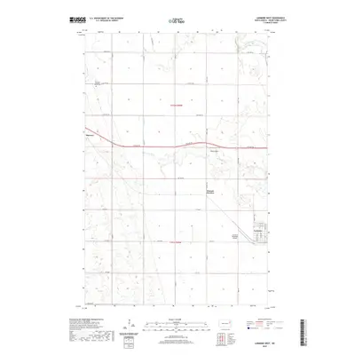
2020 Map of Larimore West
USGS Topo · Published 2020About this map
Larimore and the surrounding agricultural landscape of Grand Forks County appear here in a 2020 survey that captures the orderly grid of the Red River Valley. The settlement of Shawnee anchors the western edge, while Hannah Junction marks a intersection further east, reflecting the region's enduring transportation and drainage patterns. The land is defined by the branching paths of the N Br Turtle River and S Br Turtle River, along with Whisky Cr, which carve subtle paths through the township sections. Local history is centered at the Elm Grove Lutheran Church and its accompanying Elm Grove Lutheran Church Cem, situated among the section roads. Aviation interests are represented by the Larimore Municipal Airport and the smaller Bakke Airport, both essential for the modern rural economy.
Find a feature on this map
36 named features on this map. Tap any name to fly to it.
Don’t see what you’re looking for? This feature index may not catch every label — zoom into the map to look around manually.
Map Details
Editions of this 2020 Larimore West Map
This is the sole edition of this map. No revisions or reprints were ever made.
Other maps of this area

1936 · Larimore
USGS Topo · 1:62,500

1939 · Niagara
USGS Topo · 1:62,500

1952 · Grand Forks
USGS Topo · 1:250,000

1952 · Thief River Falls
USGS Topo · 1:250,000

1956 · Thief River Falls
USGS Topo · 1:250,000

1956 · Grand Forks
USGS Topo · 1:250,000

1957 · Thief River Falls
USGS Topo · 1:250,000

1963 · Orr
USGS Topo · 1:24,000

1963 · Larimore East
USGS Topo · 1:24,000

1963 · Kempton
USGS Topo · 1:24,000