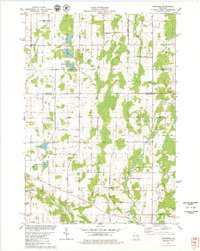
1978 Map of Larrabee
USGS Topo · Published 1979About this map
Larrabee and the surrounding rural townships of Gibson and Franklin define this late 1970s landscape along the Kewaunee and Manitowoc county line. The terrain is a complex network of small glacial lakes and drainage systems, including Harpt Lake, Engledinger Lake, and Tuma Lake, which feed the East Twin River and West Twin River. The settlement pattern remains deeply rooted in 19th-century agricultural foundations, evidenced by the numerous country cemeteries and small hamlets like Zander and Tisch Mills.
Find a feature on this map
72 named features on this map. Tap any name to fly to it.
Don’t see what you’re looking for? This feature index may not catch every label — zoom into the map to look around manually.
Map Details
Editions of this 1978 Larrabee Map
This is the sole edition of this map. No revisions or reprints were ever made.
Other maps of this area

1954 · Kewaunee
USGS Topo · 1:62,500

1954 · Manitowoc
USGS Topo · 1:62,500

1954 · Denmark
USGS Topo · 1:62,500

1954 · Reedsville
USGS Topo · 1:62,500

1954 · Manitowoc
USGS Topo · 1:250,000

1958 · Manitowoc
USGS Topo · 1:250,000

1978 · Denmark
USGS Topo · 1:24,000
1978 · Two Rivers
USGS Topo · 1:24,000

1978 · Poland
USGS Topo · 1:24,000

1978 · Stangelville
USGS Topo · 1:24,000