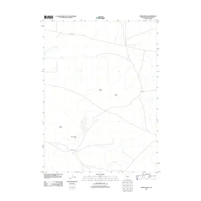
2012 Map of Larsen Knoll
USGS Topo · Published 2012About this map
Larsen Ranch stands as a focal point of human activity in this arid expanse of Sweetwater County, situated among a series of distinct high points including Larsen Knoll, Stratton Knoll, and Johnson Knoll. The landscape is defined by the ephemeral drainage of Stewart Cr and the low-lying Mud Springs Flats to the south. This 2012 survey illustrates a sparse but functional network of range roads and cutoffs, such as Riner Cutoff Rd and Stratton Rd, which facilitate movement across the basin. The presence of Mud Springs suggests the critical importance of water sources in this high-desert ranching country, where land use is dictated by the availability of spring water and the accessibility of remote grazing lands via established dirt tracks.
Find a feature on this map
9 named features on this map. Tap any name to fly to it.
Don’t see what you’re looking for? This feature index may not catch every label — zoom into the map to look around manually.
Map Details
Editions of this 2012 Larsen Knoll Map
This is the sole edition of this map. No revisions or reprints were ever made.
Other maps of this area

1954 · Rawlins
USGS Topo · 1:250,000

1955 · Casper
USGS Topo · 1:250,000

1958 · Rawlins
USGS Topo · 1:250,000

1958 · Casper
USGS Topo · 1:250,000

1960 · Hansen Lake NE
USGS Topo · 1:24,000

1960 · Sooner Reservoir
USGS Topo · 1:24,000

1960 · Larsen Knoll
USGS Topo · 1:24,000

1960 · Bull Springs
USGS Topo · 1:24,000

1960 · Buck Draw
USGS Topo · 1:24,000

1960 · Chicken Spring
USGS Topo · 1:24,000