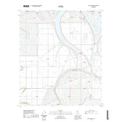
2020 Map of Larto Lake South
USGS Topo · Published 2020About this map
Larto and Argo anchor this watery landscape in the bottomlands where the Red River marks the boundary between Catahoula and Avoyelles Parishes. The region is defined by an intricate network of wetlands, sloughs, and brakes, including the notable Larto Lake and numerous backwater features like Alligator Hole Brake and Indigo Bayou. Human activity is concentrated along the ridges and levees, where State Rte 3102 and Levee Rd provide passage through the flood-prone terrain. Local heritage is preserved at small burial sites such as Nichols Cem near the northern shore and Peas Cem to the east. The presence of the Possum Bayou Hiking Trail and various landings along Saline Bayou suggests a landscape shaped by both commercial river history and modern recreation. The complex hydrology, featuring the Powell Cutoff and names like Lac à Cyprès, reflects the shifting nature of the Louisiana delta.
Find a feature on this map
55 named features on this map. Tap any name to fly to it.
Don’t see what you’re looking for? This feature index may not catch every label — zoom into the map to look around manually.
Map Details
Editions of this 2020 Larto Lake South Map
This is the sole edition of this map. No revisions or reprints were ever made.
Other maps of this area

1935 · Tooleys
USGS Topo · 1:62,500

1940 · Marksville
USGS Topo · 1:62,500

1941 · Voorhies
USGS Topo · 1:62,500

1941 · Buckeye
USGS Topo · 1:62,500

1941 · Tooleys
USGS Topo · 1:62,500

1953 · Alexandria
USGS Topo · 1:250,000

1953 · Natchez
USGS Topo · 1:250,000

1955 · Alexandria
USGS Topo · 1:250,000

1956 · Natchez
USGS Topo · 1:250,000

1959 · Natchez
USGS Topo · 1:250,000