
Loading...
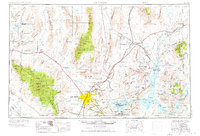
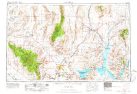
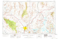
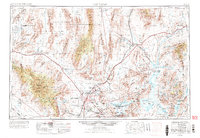
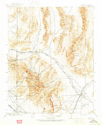
Loading map...1954 Map of Las Vegas
USGS Topo · Published 1954About this map
Las Vegas and the surrounding high desert are depicted here in the early 1950s, a period marked by significant military and infrastructure growth. The sprawling Las Vegas Bombing and Gunnery Range and Indian Springs Air Force Base occupy vast stretches of the northern landscape, reflecting the region's Cold War importance. To the east, the monumental Hoover Dam anchors the Lake Mead National Recreation Area, where the massive reservoir fills the canyons of the Virgin River.
Find a feature on this map
101 named features on this map. Tap any name to fly to it.
Don’t see what you’re looking for? This feature index may not catch every label — zoom into the map to look around manually.
Map Details
Date Portrayed1954
Date Published1954
PublisherU.S. Geological Survey
Map TypeTopographic
Scale1:250000
Physical Dimensions34.2 x 22.1 inches
Editions of this 1954 Las Vegas Map
5 editions found
Historical Maps of Santa Fe Vistas Through Time
8 maps found


Featured Locations
Source Details
SourceU.S. Geological Survey
CopyrightPublic Domain