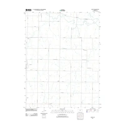
2012 Map of Lasita
USGS Topo · Published 2012About this map
Lasita and May Day anchor this portion of northern Kansas, where the landscape is defined by a rhythmic grid of rural roads and the winding paths of several creeks. The area is characterized by long-established landmarks that serve as vital records for genealogists, including Green Cem and Ebenezer Cem in the south, and May Day Cem near the northern border. Drainage patterns are prominent, with Mall Cr flowing through the central fields while Fancy Cr and the N Fork Fancy Cr traverse the northern reaches. The survey shows the modern road network, yet traces of local history remain visible in routes like L K and W Rd and Walsburg Rd, which link these small settlements to the broader agricultural region.
Find a feature on this map
45 named features on this map. Tap any name to fly to it.
Don’t see what you’re looking for? This feature index may not catch every label — zoom into the map to look around manually.
Map Details
Editions of this 2012 Lasita Map
This is the sole edition of this map. No revisions or reprints were ever made.
Other maps of this area

1886 · Junction City
USGS Topo · 1:125,000

1889 · Marysville
USGS Topo · 1:125,000

1889 · Junction City
USGS Topo · 1:125,000

1891 · Clay Center
USGS Topo · 1:125,000

1893 · Washington
USGS Topo · 1:125,000

1894 · Junction City
USGS Topo · 1:125,000

1894 · Marysville
USGS Topo · 1:125,000

1955 · Manhattan
USGS Topo · 1:250,000

1956 · Manhattan
USGS Topo · 1:250,000

1957 · Manhattan
USGS Topo · 1:250,000