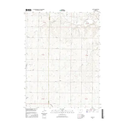
2015 Map of Lasita
USGS Topo · Published 2015About this map
Lasita sits at the heart of this agricultural landscape, marking a rural crossroads on the boundary between Clay and Riley Counties. The terrain is defined by the drainage of West Fancy Creek and Otter Cr, which carve through the plains of northern Kansas. This survey reveals a deeply rooted rural community, evident in the distribution of long-established burial grounds including Green Cem, Fancy Creek Cem, May Day Cem, and Ebenezer Cem. The presence of May Day Spring in the northeast corner highlights the importance of natural water sources in this region. The road network, composed of routes like Lasita Rd and Co Hwy 378, follows the section lines of the Public Land Survey System, illustrating the orderly division of the prairie for farming and homesteading that has persisted since the late 19th century.
Find a feature on this map
55 named features on this map. Tap any name to fly to it.
Don’t see what you’re looking for? This feature index may not catch every label — zoom into the map to look around manually.
Map Details
Editions of this 2015 Lasita Map
This is the sole edition of this map. No revisions or reprints were ever made.
Other maps of this area

1886 · Junction City
USGS Topo · 1:125,000

1889 · Marysville
USGS Topo · 1:125,000

1889 · Junction City
USGS Topo · 1:125,000

1891 · Clay Center
USGS Topo · 1:125,000

1893 · Washington
USGS Topo · 1:125,000

1894 · Junction City
USGS Topo · 1:125,000

1894 · Marysville
USGS Topo · 1:125,000

1955 · Manhattan
USGS Topo · 1:250,000

1956 · Manhattan
USGS Topo · 1:250,000

1957 · Manhattan
USGS Topo · 1:250,000