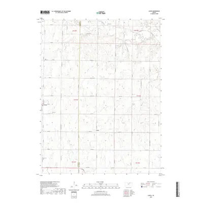
2018 Map of Lasita
USGS Topo · Published 2018About this map
Green and Lasita anchor this rural section of the Kansas prairie along the border of Clay and Riley counties. The landscape is defined by the headwaters and drainage basins of several prominent local waterways, including Mall Cr flowing through the southwest and the winding path of West Fancy Creek in the north. This 2018 study details a dense network of sectional roads and historical landmarks that have served the farming community for generations. Several well-established burial grounds, such as Fancy Creek Cem, May Day Cem, and Green Cem, are distributed across the terrain, offering significant points of interest for genealogists tracking early settler families. The presence of May Day Spring and the complex confluence of Otter Cr and N Fork Fancy Cr highlight the vital role of natural water sources in the region's agricultural development and settlement patterns.
Find a feature on this map
58 named features on this map. Tap any name to fly to it.
Don’t see what you’re looking for? This feature index may not catch every label — zoom into the map to look around manually.
Map Details
Editions of this 2018 Lasita Map
This is the sole edition of this map. No revisions or reprints were ever made.
Other maps of this area

1886 · Junction City
USGS Topo · 1:125,000

1889 · Marysville
USGS Topo · 1:125,000

1889 · Junction City
USGS Topo · 1:125,000

1891 · Clay Center
USGS Topo · 1:125,000

1893 · Washington
USGS Topo · 1:125,000

1894 · Junction City
USGS Topo · 1:125,000

1894 · Marysville
USGS Topo · 1:125,000

1955 · Manhattan
USGS Topo · 1:250,000

1956 · Manhattan
USGS Topo · 1:250,000

1957 · Manhattan
USGS Topo · 1:250,000