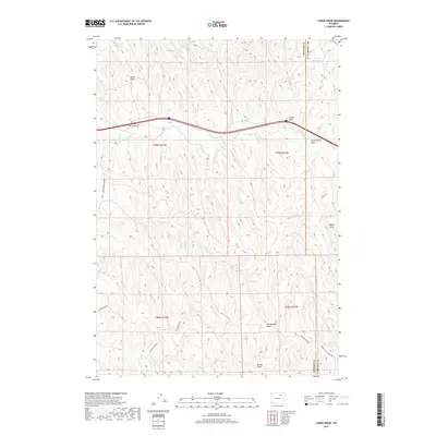
2017 Map of Laskie Draw
USGS Topo · Published 2017About this map
Laskie Draw and the surrounding drainage basins of Campbell and Johnson Counties define this high plains landscape during the early 21st century. The map reveals a highly developed network of rural infrastructure, characterized by numerous stock reservoirs such as Bombsite Reservoir, Laskie Reservoir, and California Reservoir. These small-scale water management features, scattered among the draws and ridges, underscore the region's reliance on intermittent water sources like Dead Horse Cr for livestock and land management.
Find a feature on this map
21 named features on this map. Tap any name to fly to it.
Don’t see what you’re looking for? This feature index may not catch every label — zoom into the map to look around manually.
Map Details
Editions of this 2017 Laskie Draw Map
This is the sole edition of this map. No revisions or reprints were ever made.
Other maps of this area

1954 · Gillette
USGS Topo · 1:250,000

1955 · Sheridan
USGS Topo · 1:250,000

1955 · Gillette
USGS Topo · 1:250,000

1958 · Gillette
USGS Topo · 1:250,000

1958 · Sheridan
USGS Topo · 1:250,000

1962 · Gillette
USGS Topo · 1:250,000

1962 · Sheridan
USGS Topo · 1:250,000
1971 · Bogie Draw
USGS Topo · 1:24,000
1971 · Morgan Draw
USGS Topo · 1:24,000
1972 · Carr Draw
USGS Topo · 1:24,000