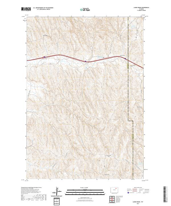
2021 Map of Laskie Draw
USGS Topo · Published 2021About this map
The high plains of the Powder River Basin are defined here by a series of intermittent drainage systems, most notably Laskie Draw and Doud Draw, which cut through the landscape of Johnson and Campbell Counties. In this arid cattle-country environment, water management is evident through a network of small impoundments such as Laskie Reservoir, Bombsite Reservoir, and California Reservoir. These reservoirs served the needs of local ranchers in an era when reliable water sources were critical for maintaining livestock across the sprawling range.
Find a feature on this map
20 named features on this map. Tap any name to fly to it.
Don’t see what you’re looking for? This feature index may not catch every label — zoom into the map to look around manually.
Map Details
Editions of this 2021 Laskie Draw Map
This is the sole edition of this map. No revisions or reprints were ever made.
Other maps of this area

1954 · Gillette
USGS Topo · 1:250,000

1955 · Sheridan
USGS Topo · 1:250,000

1955 · Gillette
USGS Topo · 1:250,000

1958 · Gillette
USGS Topo · 1:250,000

1958 · Sheridan
USGS Topo · 1:250,000

1962 · Gillette
USGS Topo · 1:250,000

1962 · Sheridan
USGS Topo · 1:250,000
1971 · Bogie Draw
USGS Topo · 1:24,000
1971 · Morgan Draw
USGS Topo · 1:24,000
1972 · Carr Draw
USGS Topo · 1:24,000