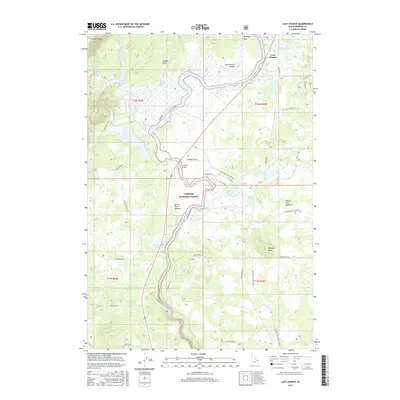
2017 Map of Last Chance
USGS Topo · Published 2017About this map
Henrys Fork snakes through the center of this high-altitude landscape, defining the geographic character of the Targhee National Forest as it flows south toward the Osborne Bridge. The area is geographically unique for its volcanic history, encompassing portions of the Island Park Caldera and Henrys Fork Caldera. Notable water bodies including Golden Lake, Silver Lake, and Swan Lake are scattered across the terrain, reflecting the complex drainage patterns of the Continental Divide.
Find a feature on this map
49 named features on this map. Tap any name to fly to it.
Don’t see what you’re looking for? This feature index may not catch every label — zoom into the map to look around manually.
Map Details
Editions of this 2017 Last Chance Map
This is the sole edition of this map. No revisions or reprints were ever made.
Other maps of this area

1955 · Ashton
USGS Topo · 1:250,000

1958 · Ashton
USGS Topo · 1:250,000

1960 · Ashton
USGS Topo · 1:250,000

1964 · Hatchery Butte
USGS Topo · 1:24,000

1964 · Island Park
USGS Topo · 1:24,000

1964 · Island Park Dam
USGS Topo · 1:24,000

1964 · Last Chance
USGS Topo · 1:24,000

1965 · Lookout Butte
USGS Topo · 1:24,000

1965 · Snake River Butte
USGS Topo · 1:24,000

1965 · Blue Creek Reservoir
USGS Topo · 1:24,000