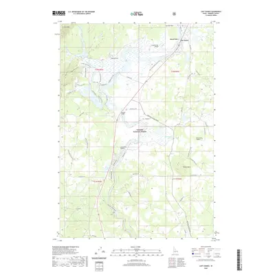
2020 Map of Last Chance
USGS Topo · Published 2020About this map
Henry's Fork winds through the heart of this landscape, a vital water source that has long defined the geography of eastern Idaho. This 2020 record of the Targhee National Forest reveals a dense network of forest roads and trails, including the Mesa Falls Scenic Byway and the Bing Lempke (North Gate) Trail, illustrating how the region serves as both a recreational hub and a managed wilderness. The terrain is marked by significant geological features like the Island Park Caldera and the Continental Divide, which runs across the northern sections near Antelope Park.
Find a feature on this map
60 named features on this map. Tap any name to fly to it.
Don’t see what you’re looking for? This feature index may not catch every label — zoom into the map to look around manually.
Map Details
Editions of this 2020 Last Chance Map
This is the sole edition of this map. No revisions or reprints were ever made.
Other maps of this area

1955 · Ashton
USGS Topo · 1:250,000

1958 · Ashton
USGS Topo · 1:250,000

1960 · Ashton
USGS Topo · 1:250,000

1964 · Hatchery Butte
USGS Topo · 1:24,000

1964 · Island Park
USGS Topo · 1:24,000

1964 · Island Park Dam
USGS Topo · 1:24,000

1964 · Last Chance
USGS Topo · 1:24,000

1965 · Lookout Butte
USGS Topo · 1:24,000

1965 · Snake River Butte
USGS Topo · 1:24,000

1965 · Blue Creek Reservoir
USGS Topo · 1:24,000