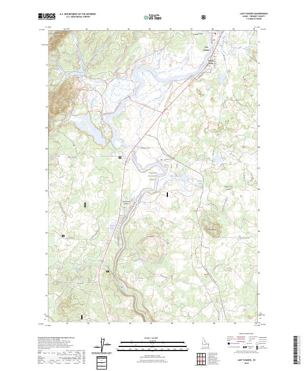
2024 Map of Last Chance
USGS Topo · Published 2024About this map
Island Park and the small community of Last Chance occupy a unique geological position within the massive Island Park Caldera. This volcanic landscape is defined by the winding course of Henry's Fork, which flows past landmarks like Swan Lake and through the Targhee National Forest. The map documents a complex network of forest access and recreation paths, including the Mesa Falls Scenic Byway and several family-named or ranch-related trails such as the Big Bend Loop Trl and Bing Lempke (North Gate) Trl.
Find a feature on this map
54 named features on this map. Tap any name to fly to it.
Don’t see what you’re looking for? This feature index may not catch every label — zoom into the map to look around manually.
Map Details
Editions of this 2024 Last Chance Map
This is the sole edition of this map. No revisions or reprints were ever made.
Other maps of this area

1955 · Ashton
USGS Topo · 1:250,000

1958 · Ashton
USGS Topo · 1:250,000

1960 · Ashton
USGS Topo · 1:250,000

1964 · Hatchery Butte
USGS Topo · 1:24,000

1964 · Island Park
USGS Topo · 1:24,000

1964 · Island Park Dam
USGS Topo · 1:24,000

1964 · Last Chance
USGS Topo · 1:24,000

1965 · Lookout Butte
USGS Topo · 1:24,000

1965 · Snake River Butte
USGS Topo · 1:24,000

1965 · Blue Creek Reservoir
USGS Topo · 1:24,000