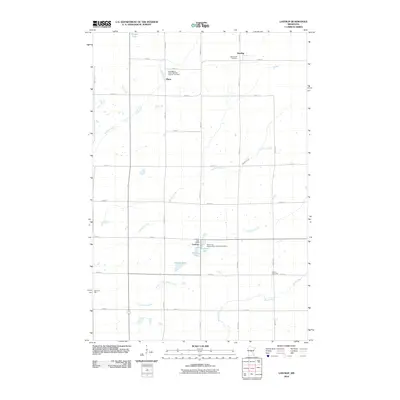
2010 Map of Lastrup
USGS Topo · Published 2010About this map
Lastrup serves as a primary local hub in this rural Morrison County landscape, which remains defined by its agricultural layout and water systems. The map captures a high concentration of institutional landmarks that provide significant value for genealogists, including Saint Mary's Polish National Catholic Cemetery and Saint John Nepomucene Catholic Cemetery, reflecting the cultural heritage of the early settlers. The drainage patterns of Big Mink Creek and Little Mink Creek feed into larger arteries like the Platte River and Skunk River, shaping the township boundaries. Local governance and community life are anchored at the Granite Town Hall and Buh Town Hall, while the village of Platte remains a distinct point of interest amidst a network of section-line roads.
Find a feature on this map
33 named features on this map. Tap any name to fly to it.
Don’t see what you’re looking for? This feature index may not catch every label — zoom into the map to look around manually.
Map Details
Editions of this 2010 Lastrup Map
This is the sole edition of this map. No revisions or reprints were ever made.
Other maps of this area

1948 · Pierz
USGS Topo · 1:62,500

1948 · Lastrup
USGS Topo · 1:62,500

1950 · Lastrup
USGS Topo · 1:62,500

1950 · Pierz
USGS Topo · 1:62,500

1953 · Duluth
USGS Topo · 1:250,000

1953 · Brainerd
USGS Topo · 1:250,000

1953 · Saint Cloud
USGS Topo · 1:250,000

1953 · Stillwater
USGS Topo · 1:250,000

1955 · Stillwater
USGS Topo · 1:250,000

1957 · Brainerd
USGS Topo · 1:250,000