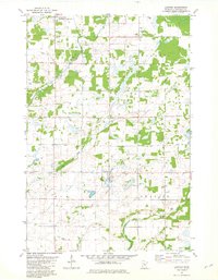
1981 Map of Lastrup
USGS Topo · Published 1982About this map
Lastrup serves as the focal point of this central Minnesota landscape, situated at the junction of several drainage systems during the early 1980s. The terrain is defined by its complex hydrology, where the Platte River and Skunk River flow through a region marked by numerous small glacial lakes and wetlands. Local spiritual and social life is anchored by landmarks such as Holy Cross Ch in Harding and the Free Polish National Ch further west, reflecting the area's cultural heritage.
Find a feature on this map
21 named features on this map. Tap any name to fly to it.
Don’t see what you’re looking for? This feature index may not catch every label — zoom into the map to look around manually.
Map Details
Editions of this 1981 Lastrup Map
This is the sole edition of this map. No revisions or reprints were ever made.
Other maps of this area

1948 · Pierz
USGS Topo · 1:62,500

1948 · Lastrup
USGS Topo · 1:62,500

1950 · Lastrup
USGS Topo · 1:62,500

1950 · Pierz
USGS Topo · 1:62,500

1953 · Duluth
USGS Topo · 1:250,000

1953 · Brainerd
USGS Topo · 1:250,000

1953 · Saint Cloud
USGS Topo · 1:250,000

1953 · Stillwater
USGS Topo · 1:250,000

1955 · Stillwater
USGS Topo · 1:250,000

1957 · Brainerd
USGS Topo · 1:250,000