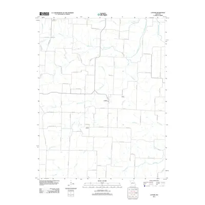
2011 Map of Latham
USGS Topo · Published 2011About this map
The unincorporated community of Latham serves as the focal point for this rural landscape in Moniteau County. Settled within a complex network of creek drainages, the area is defined by the headwaters and branches of North Moreau Creek, Burris Fork, and the curiously named Turkey Trot Creek. The road network follows the undulating terrain, with routes like State Hwy E and Lick Fork Rd connecting scattered farmsteads and residential clusters like Wilderness Acres. Genealogists will find significant value in the documentation of local burial sites, including the Moreau Cemetery, Latham Cemetery, and Highland Cemetery. The map also preserves the memory of local education through the naming of Westview School Rd, indicating the former site of a rural schoolhouse that once anchored the surrounding farming community.
Find a feature on this map
76 named features on this map. Tap any name to fly to it.
Don’t see what you’re looking for? This feature index may not catch every label — zoom into the map to look around manually.
Map Details
Editions of this 2011 Latham Map
This is the sole edition of this map. No revisions or reprints were ever made.
Other maps of this area

1888 · Versailles
USGS Topo · 1:125,000

1888 · Boonville
USGS Topo · 1:125,000

1893 · Versailles
USGS Topo · 1:125,000

1904 · Eldon
USGS Topo · 1:62,500

1904 · Gravois Mills
USGS Topo · 1:62,500

1947 · Jefferson City
USGS Topo · 1:250,000

1949 · Gravois Mills
USGS Topo · 1:62,500

1951 · California South
USGS Topo · 1:24,000

1951 · Latham
USGS Topo · 1:24,000

1952 · Tipton
USGS Topo · 1:24,000