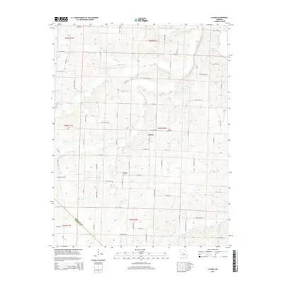
2015 Map of Latham
USGS Topo · Published 2015About this map
Latham serves as the central hub of this agricultural landscape in Moniteau County, characterized by a dense network of country roads and family-named landmarks. The terrain is deeply carved by a complex drainage system, including the headwaters of North Moreau Creek and the meandering Burris Fork near R Elliott Lake. This topography shaped the placement of local institutions, with Bethel Church and Westview School positioned on higher ground away from the flood-prone valleys of Turkey Trot Cr and Lick Cr. Genealogists will find significant value in the mapped locations of Latham Cemetery, Highland Cemetery, and Moreau Cemetery, which provide geographic context for early residents. The numerous named roads, such as Pilot Grove Rd and Reno Hill Rd, trace historical transit patterns through the township lines of T44N R16W and T45N R16W.
Find a feature on this map
74 named features on this map. Tap any name to fly to it.
Don’t see what you’re looking for? This feature index may not catch every label — zoom into the map to look around manually.
Map Details
Editions of this 2015 Latham Map
This is the sole edition of this map. No revisions or reprints were ever made.
Other maps of this area

1888 · Versailles
USGS Topo · 1:125,000

1888 · Boonville
USGS Topo · 1:125,000

1893 · Versailles
USGS Topo · 1:125,000

1904 · Eldon
USGS Topo · 1:62,500

1904 · Gravois Mills
USGS Topo · 1:62,500

1947 · Jefferson City
USGS Topo · 1:250,000

1949 · Gravois Mills
USGS Topo · 1:62,500

1951 · California South
USGS Topo · 1:24,000

1951 · Latham
USGS Topo · 1:24,000

1952 · Tipton
USGS Topo · 1:24,000