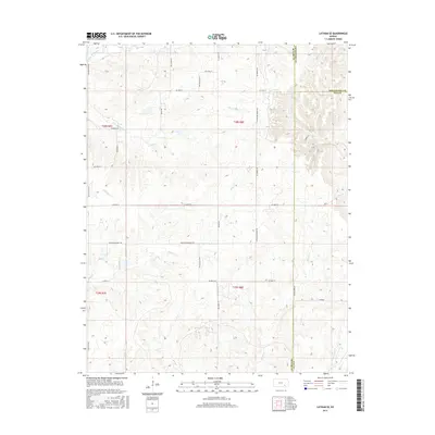
2015 Map of Latham SE
USGS Topo · Published 2015About this map
Elk River and its numerous tributaries dominate this high-plains landscape where Butler, Greenwood, and Elk counties meet. The drainage patterns are intricate, with Rock Creek, Grouse Creek, and Wagoner Creek carving through the terrain, illustrating the headwater network of southeastern Kansas. The human footprint is defined by a sparse but precise grid of rural routes, including Latham Beaumont Road and SE Flinthills Road, which navigate around the natural creek breaks. This 2015 data provides a clear view of land management and hydrology in the region, highlighting the various branches of S Br Hickory Creek and N Br Rock Creek as they distribute across the township and range sections.
Find a feature on this map
37 named features on this map. Tap any name to fly to it.
Don’t see what you’re looking for? This feature index may not catch every label — zoom into the map to look around manually.
Map Details
Editions of this 2015 Latham SE Map
This is the sole edition of this map. No revisions or reprints were ever made.
Other maps of this area

1885 · Eureka
USGS Topo · 1:125,000

1885 · Sedan
USGS Topo · 1:125,000

1888 · Eureka
USGS Topo · 1:125,000

1888 · Eldorado
USGS Topo · 1:125,000

1889 · Burden
USGS Topo · 1:125,000

1889 · Sedan
USGS Topo · 1:125,000

1894 · Eureka
USGS Topo · 1:125,000

1955 · Wichita
USGS Topo · 1:250,000

1958 · Wichita
USGS Topo · 1:250,000
1964 · Piedmont SW
USGS Topo · 1:24,000