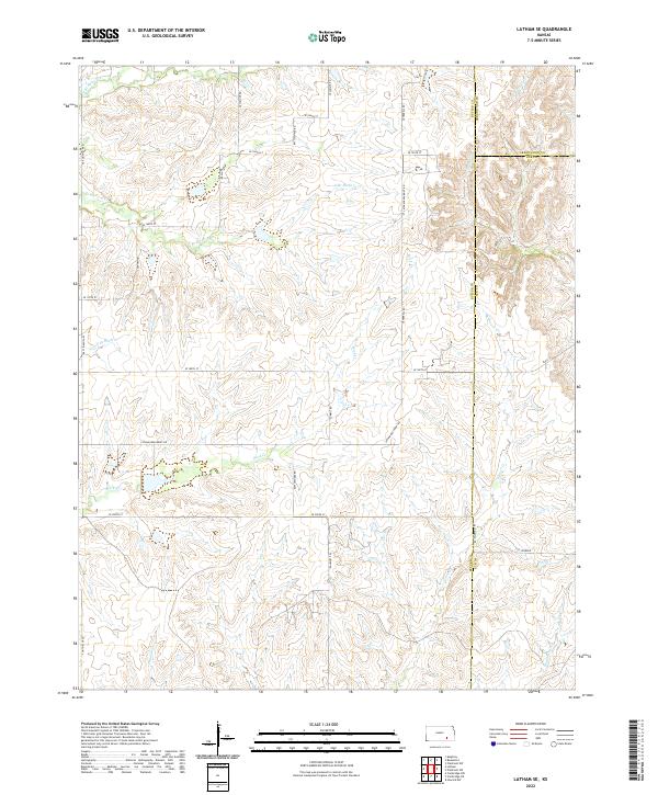
2022 Map of Latham SE
USGS Topo · Published 2022About this map
The headwaters of the Elk River and several major prairie drainages converge at the intersection of Butler, Greenwood, and Elk Counties. This transition zone in southeastern Kansas is defined by the winding paths of Rock Cr, Grouse Cr, and Franklin Cr, which carve through the undulating terrain. The landscape is primarily divided by the Public Land Survey System, with township lines for t28s r7e and t29s r8e providing the structural grid for rural development. A network of section-line roads, such as SE Flinthills Rd and SE 200th St, serves the sparse agricultural settlements. Local transport history is visible in the alignment of the Latham-Beaumont Rd, which cuts diagonally across the topography, connecting the area to regional centers while passing landmarks like Pioneer in the southeastern corner.
Find a feature on this map
30 named features on this map. Tap any name to fly to it.
Don’t see what you’re looking for? This feature index may not catch every label — zoom into the map to look around manually.
Map Details
Editions of this 2022 Latham SE Map
This is the sole edition of this map. No revisions or reprints were ever made.
Other maps of this area

1885 · Eureka
USGS Topo · 1:125,000

1885 · Sedan
USGS Topo · 1:125,000

1888 · Eureka
USGS Topo · 1:125,000

1888 · Eldorado
USGS Topo · 1:125,000

1889 · Burden
USGS Topo · 1:125,000

1889 · Sedan
USGS Topo · 1:125,000

1894 · Eureka
USGS Topo · 1:125,000

1955 · Wichita
USGS Topo · 1:250,000

1958 · Wichita
USGS Topo · 1:250,000
1964 · Piedmont SW
USGS Topo · 1:24,000