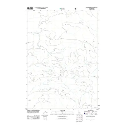
2011 Map of Latham Spring
USGS Topo · Published 2011About this map
Latham Spring and the intricate drainage basins of the Idaho-Montana border dominate this high-elevation landscape. The topography is defined by the branching headwaters of Split Creek, which includes the North Fork Split Creek, Middle Fork Split Creek, and South Fork Split Creek. This area is carved by a network of seasonal and perennial waterways such as Thirsty Creek and the winding Moose Creek.
Find a feature on this map
17 named features on this map. Tap any name to fly to it.
Don’t see what you’re looking for? This feature index may not catch every label — zoom into the map to look around manually.
Map Details
Editions of this 2011 Latham Spring Map
This is the sole edition of this map. No revisions or reprints were ever made.
Other maps of this area

1955 · Ashton
USGS Topo · 1:250,000

1957 · Buffalo Lake
USGS Topo · 1:62,500

1958 · Ashton
USGS Topo · 1:250,000

1958 · West Yellowstone
USGS Topo · 1:62,500

1960 · Ashton
USGS Topo · 1:250,000

1964 · Hatchery Butte
USGS Topo · 1:24,000

1964 · Island Park
USGS Topo · 1:24,000

1964 · Big Springs
USGS Topo · 1:24,000

1964 · Henrys Lake
USGS Topo · 1:62,500
1986 · Jack Straw Basin
USGS Topo · 1:24,000