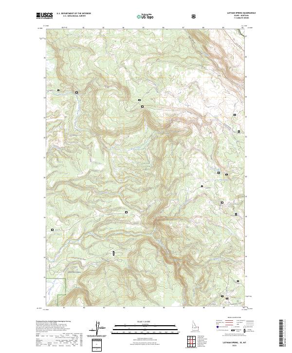
2023 Map of Latham Spring
USGS Topo · Published 2023About this map
Targhee National Forest defines this high-elevation Idaho landscape, where the northern rim of the Island Park Caldera transitions into a network of steep canyons and timbered ridges. The drainage pattern is dominated by the Buffalo River and Warm River, with numerous tributaries such as Fish Creek, Moose Creek, and the multi-branched Split Creek cutting through the volcanic terrain.
Find a feature on this map
32 named features on this map. Tap any name to fly to it.
Don’t see what you’re looking for? This feature index may not catch every label — zoom into the map to look around manually.
Map Details
Editions of this 2023 Latham Spring Map
This is the sole edition of this map. No revisions or reprints were ever made.
Other maps of this area

1955 · Ashton
USGS Topo · 1:250,000

1957 · Buffalo Lake
USGS Topo · 1:62,500

1958 · Ashton
USGS Topo · 1:250,000

1958 · West Yellowstone
USGS Topo · 1:62,500

1960 · Ashton
USGS Topo · 1:250,000

1964 · Hatchery Butte
USGS Topo · 1:24,000

1964 · Island Park
USGS Topo · 1:24,000

1964 · Big Springs
USGS Topo · 1:24,000

1964 · Henrys Lake
USGS Topo · 1:62,500
1986 · Jack Straw Basin
USGS Topo · 1:24,000