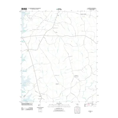
2011 Map of Latimer
USGS Topo · Published 2011About this map
Richard B Russell Lake dominates the western edge of this Abbeville County landscape, where the waters of the Rocky River and Gill Creek meet the reservoir. The interior terrain is defined by a dense network of country roads named for local families, such as Maynard Rd, Bouchillon Rd, and Tom Crawford Rd. This rural area is anchored by the small settlements of Brownlee Crossroads and Latimer, the latter situated near the southern boundary along State Hwy 1 96.
Find a feature on this map
61 named features on this map. Tap any name to fly to it.
Don’t see what you’re looking for? This feature index may not catch every label — zoom into the map to look around manually.
Map Details
Editions of this 2011 Latimer Map
This is the sole edition of this map. No revisions or reprints were ever made.
Other maps of this area

1892 · Abbeville
USGS Topo · 1:125,000

1893 · Elberton
USGS Topo · 1:125,000

1948 · Abbeville West
USGS Topo · 1:24,000

1949 · Abbeville
USGS Topo · 1:24,000

1949 · Calhoun Creek
USGS Topo · 1:24,000

1954 · Greenville
USGS Topo · 1:250,000

1958 · Greenville
USGS Topo · 1:250,000

1964 · Iva
USGS Topo · 1:24,000

1964 · Antreville
USGS Topo · 1:24,000

1964 · Lowndesville
USGS Topo · 1:24,000